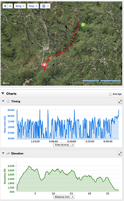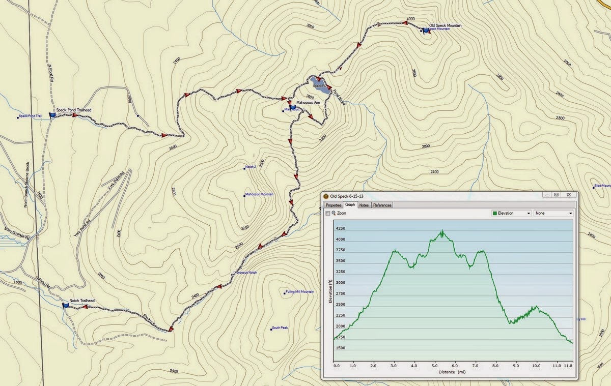
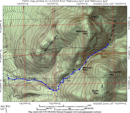
Traversing 31M through the Mahoosuc Notch, NH/Maine

Elev Gain: 11,457'           Elev Loss: 10,656'            Max Elev: 4206'            Min Elev: 742'
July 6-7, 2018
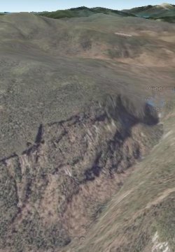
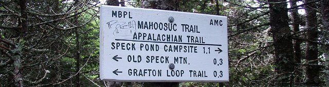
The Mahoosuc Notch, widely considered the most difficult mile on the entire AT, is a gorge filled with massive boulders, some as big as houses. The “Mahoosuc Mile” nestles in a deep notch between Speck Mountain and Goose Eye Mountain, running concurrently on Old Speck Trail, Mahoosuc Trail, Goose Eye Trail, and Peabody Brook Trail; climbing Old Speck Mountain, Fulling Mill Mountain (South Peak), Goose Eye Mountain (North Peak), Goose Eye Mountain (East Peak), Goose Eye Mountain (West Peak), Mt. Carlo, and Mt. Success. While this traverse deservedly belongs in the same genre as the Pemi Loop and Presi Traverse, it is perhaps the hardest of the three.. With steep cliffs on either side and what appears to be no other alternative, trail builders routed the pathway through a mile long boulder field before climbing steeply back into the mountains on both sides. Scrambling through the Notch, temperatures can plummet up to thirty degrees from lingering ice and snow, like walking into a cooler.
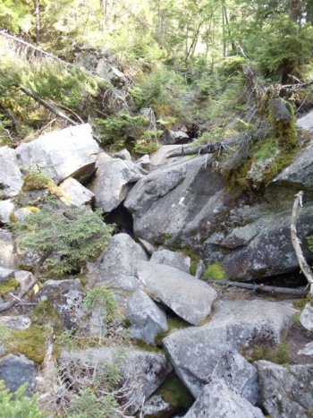
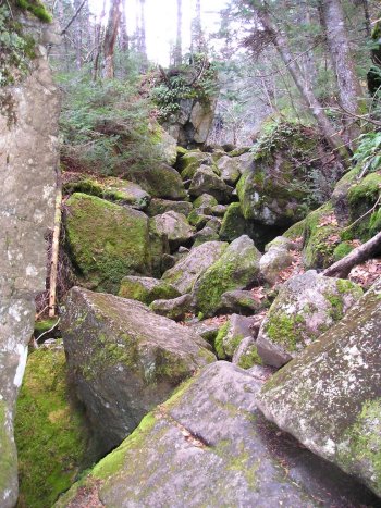
The Notch isn’t physically taxing when compared to the rest of hiking in the Mahoosuc Range. Instead it is more technically difficult. Navigating the boulders requires going over some while squeezing through cracks and caves in other areas. Doing so with a pack on your back throws your balance off and makes it all that more difficult to squeeze through tight spaces. There’s also a decent risk of injury if you aren’t careful, especially if it is wet. Not only seriously challenging, this is an awesome adventure.
%20247.jpg)
Following the Appalachian Trail, we will begin at the parking area on Highway 2 east of Gorham, NH, and finish at the parking area on Maine Highway 26 at Grafton Notch, followed by eats and drinks at Sunday River Brewery located where Maine 26 intersects with Highway 2 to the east.
|
US
2, Gorham, NH
|
780'
|
Start
|
0
|
|
Androscoggin
River
|
750'
|
W
|
.1
|
|
Hogan
Road
|
760'
|
.5
|
|
|
brook
|
1350'
|
W
|
1.5
|
|
Mt.
Hayes, Mahoosic Trail
|
2555'
|
3.6
|
|
|
Cacade
Mountain
|
2631'
|
5.8
|
|
|
Trident
Col tentsite
|
2020'
|
W,
C
|
6.9
|
|
Dream
Lake
|
2600'
|
W
|
9.6
|
|
Moss
Pond
|
2630'
|
W
|
11.1
|
|
Gentain
Pond Shelter
|
2166'
|
W,
S
|
11.8
|
|
Mt.
Success
|
3565'
|
14.6
|
|
|
NH/Main
State Line
|
2972'
|
16.5
|
|
|
Carlo
Col Shelter
|
2945'
|
W,
S
|
16.9
|
|
Mt.
Carlo
|
3565'
|
17.3
|
|
|
Goose
Eye Mtn (east peak)
|
3790'
|
19.1
|
|
|
Goose
Eye Mtn (north peak)
|
3675'
|
20.3
|
|
|
Full
Goose Shelter
|
3030'
|
W,
S
|
21.3
|
|
Fulling
Mill Mtn
|
3395'
|
21.8
|
|
|
Mahoosuc
Notch (west end)
|
2400'
|
W
|
22.8
|
|
Mahoosuc
Notch (east end)
|
2150'
|
W
|
23.9
|
|
Mahoosuc
Arm
|
3770'
|
25.5
|
|
|
Speck
Pond Shelter
|
3500'
|
W,
S
|
26.2
|
|
Old
Speck Trail
|
3589'
|
27.3
|
|
|
brook
|
2500'
|
W
|
29.7
|
|
Grafton
Notch
|
1495'
|
30.8
|
Mt
Washington Observatory Mountain
Forecast Trail
Conditions Trails
NH Views
From The Top Road
Status
FAQ
FKT
WEATHER
/ RADAR
/ TRAIL
CONDITIONS