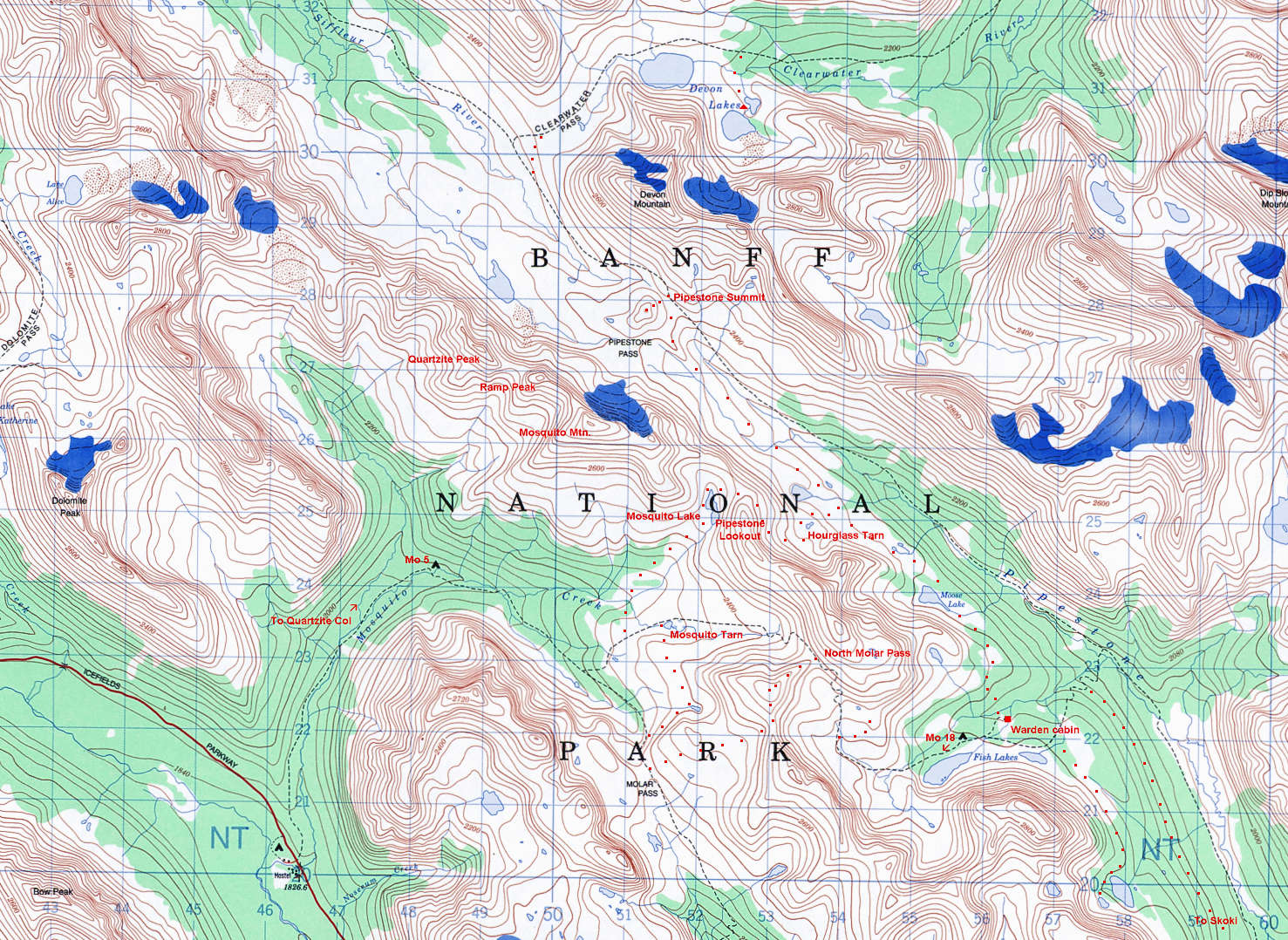
North Molar Pass to Fish/Devon Lakes  61 km O&B Run in Banff NP -  Alberta
RT Elevation Gain:  ~ 6235'
July 24, 2017
Trailhead to Fish Lakes camp (one-way): 14.8 km............Fish Lakes to Devon Lakes (one-way): 15.7 km No Day Permit Required. Bring bear spray.
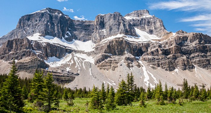
The Devon Lakes are two remote alpine lakes in the heart of Banff National Park. At over 30 km by trail from the nearest road and with 3 mountain passes to traverse to reach them, they are beautifully wild and isolated. This run isn't only about the destination, however, as a full 22 kilometers of the journey (over 60 km round trip!) is essentially above treeline with alpine meadows stretching as far as one can see.
The trail starts on the east side of the Icefields Parkway north of Lake Louise across from the Mosquito Creek Hostel. An initial steep climb quickly dissipates into a gentle ascent, reaching Mosquito Creek backcountry campground in 5 km. After the campground the trail steepens and deteriorates, becoming a mix of roots, mud, and streambed that distracts you from the fact that you're slogging through forest at the moment. Around the 8 km mark, however, you emerge into the expansive meadows of North Molar Pass and from this point forward, with a few minor exceptions, you will be above treeline. The meadows simply defy description; just crossing the meadow you just entered requires an hour or more. Tarns, streams, and flowers are everywhere.The trail can be quite rough and muddy for much of the way below the treeline until later in the summer.
The approach to North Molar Pass is obvious and the final ascent up the rocky slopes is far easier and much shorter than it appears from a distance. Upon crossing the pass you are greeted with about 3 km more of meadows and towering peaks. The Fish Lakes campground is about 3.5 km away at this point, down through the gap visible to the left in the distance. It should be noted that near the bottom of the descent a stream will be encountered that may be too deep to rock-hop. There is a bridge further downstream if needed!
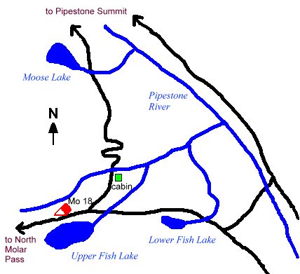
Fish Lakes campground lies on the northern shore of Upper Fish Lake near the eastern end of the lake. It has 4 picnic tables, a bear pole, and a clean outhouse. While Devon Lakes can be reached from here by descending into the Pipestone River valley and ascending to Pipestone Pass, this makes no sense whatsoever as a trail also exists much higher up that offers vastly superior scenery and far less elevation gain and loss. It is known as the "highline route". To find the trail, head roughly north (downhill) from the outhouse, cross the stream, then ascend the hill. It's steep, but less than 100 m up. As you climb, curve north-northeastwards. With a little routefinding, you will encounter a trail that contours to the north, then descends to Moose Lake. (If you come to the top of a cliff, just follow it north and you'll connect up with the trail). The trail shortly becomes very obvious as it gently undulates through meadows filled with patchy trees, tarns, and streams.
From this point forward just follow the trail over Pipestone Pass and into Clearwater Pass. The scenery again defies description. A few forks in the trail on the approach to Pipestone Pass all reconnect later on; just be sure you're aiming for the actual pass - it is the gap to the east (right), not the west. Clearwater Pass lies to the north of the broad mountain (Devon Mountain) flanking Pipestone Pass to the east. When it starts to look like there might be a route around it, keep your eye out for a fork in the trail doing just this. It is marked with a small cairn and while the main trail will also eventually head into Clearwater Pass this shortcut avoids losing elevation that would need to be regained. Clearwater Pass is a huge alpine meadow. Near the eastern end are the two Devon Lakes; the further one being the smaller of the two and about 30 m lower. From here the run will return the way we came.
Mosquito Valley from North Molar Pass