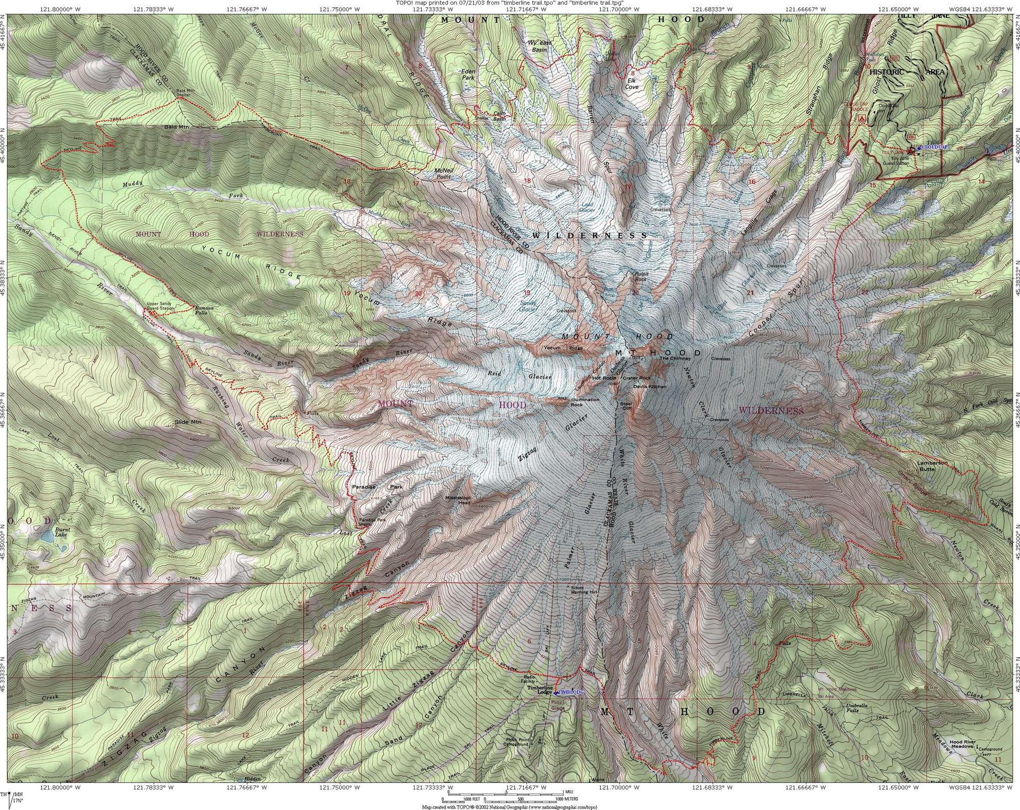
Running the 42M Timberline Trail Loop, Mt. Hood, Oregon
 Elevation gain: 8000 feet                 High Point: 7350 feet            Mt. Hood Elevation:  11,249'
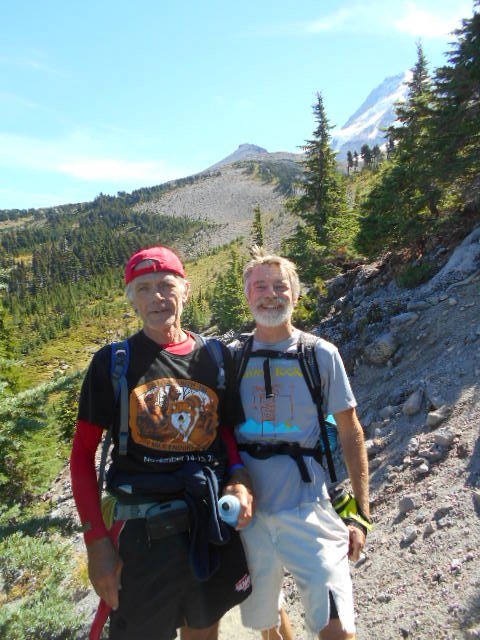
September 9, 2016 with John Zeier Volcano Running
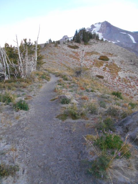
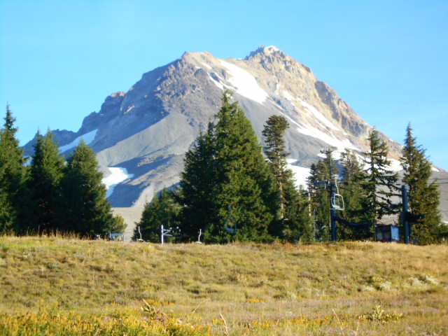
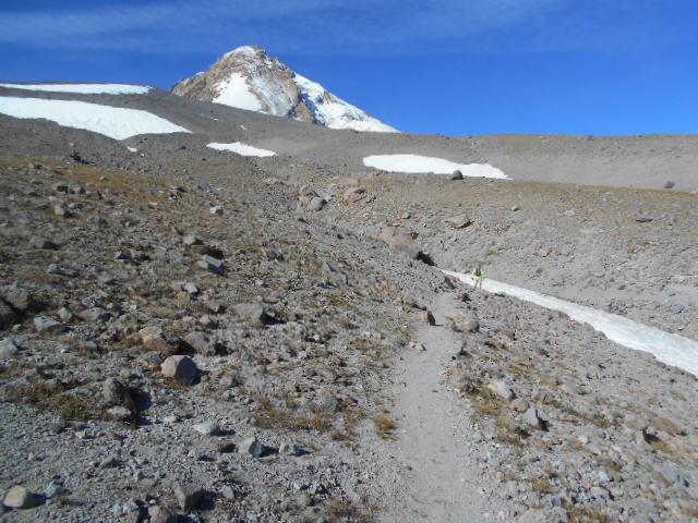
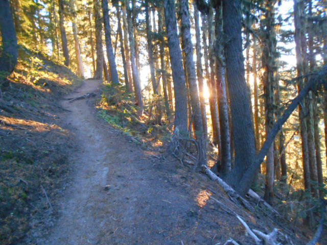
Meeting at the Timberline Lodge on the south side of Mt. Hood, John Zeier and I were off and running in the pre-dawn light by 0630. A local from Vancouver, Washington, John had completed the loop around Mt. Hood three times previously and decided a CCW route was best. Directly off the Lodge's parking lot we dove into a rocky gully to find the Timberline Trail heading east towards the sunrise. Following a long rib downhill we joined the PCT in about a mile and a half. While there are some cairns, the exact route of the Timberline Trail varies somewhat from year to year in exposed areas unprotcted by trees. It was important to pay attention to the trail and signage throughout the day.

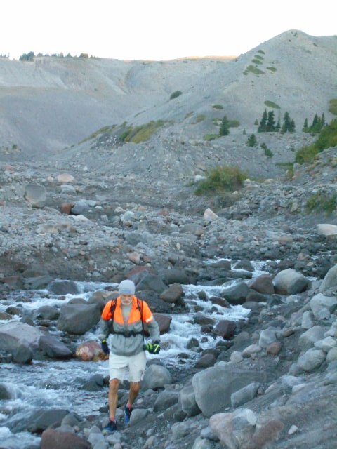
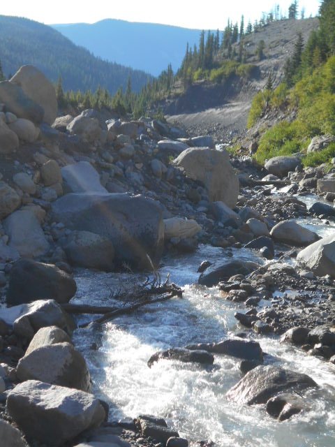
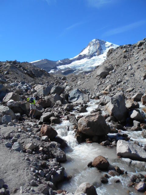
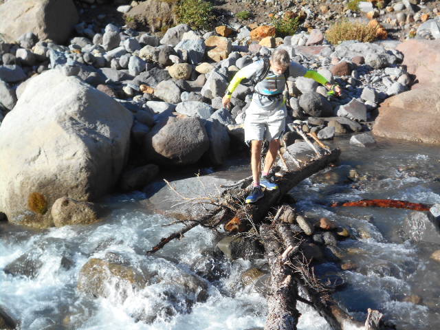
After engaging the PCT it wasn't long before we made our first of a half dozen river crossings - the White River. With fair weather prevailing over the region for the week the river levels were down, enabling us to cross all streams without much challenge throughout the day. For once, I kept my feet dry.
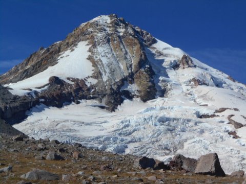
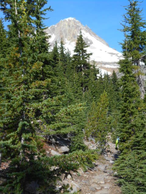
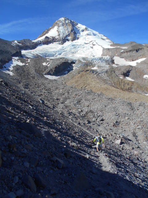
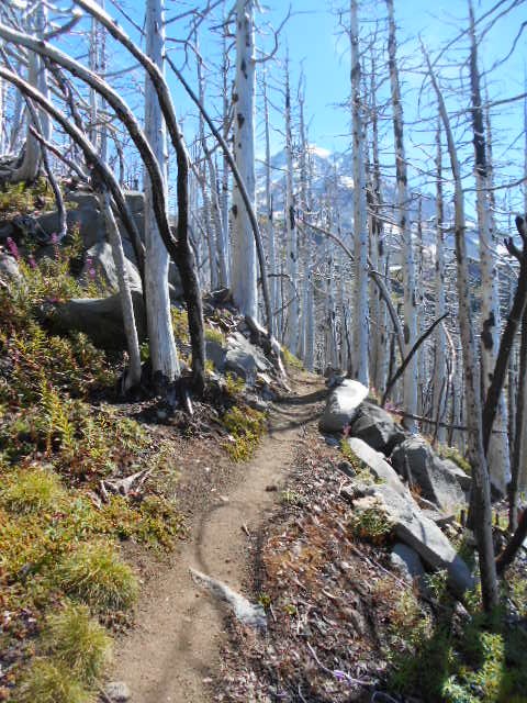
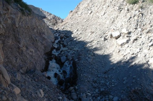
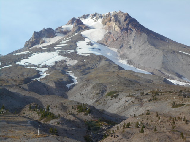
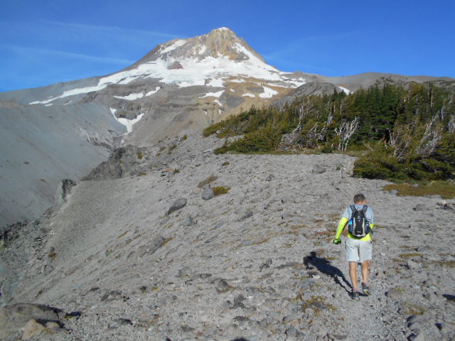
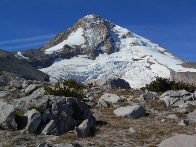
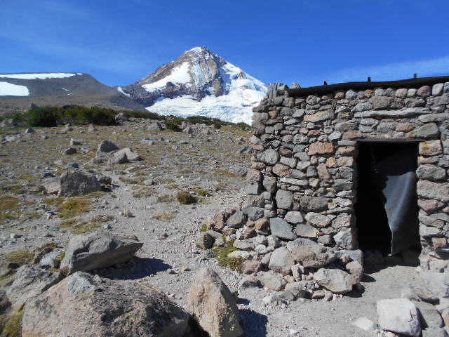
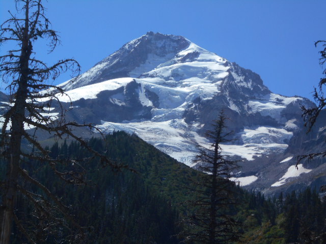
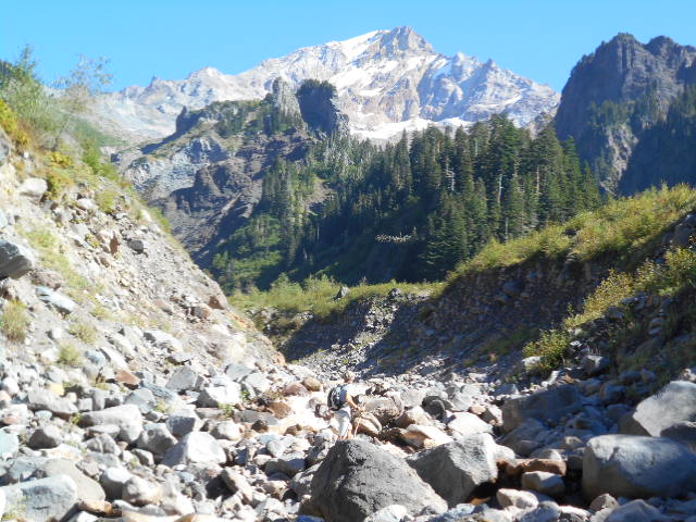
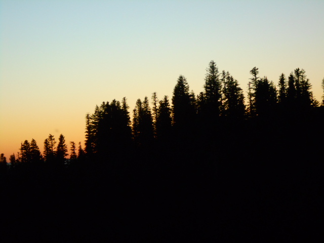
As we moved along, the many faces of Mt. Hood evolved through the day; she is a beautiful lady adorned in her glacial array and I never tired of seeing her fresh face from different angles. After running by a stone house on Gnarl Ridge, used as a refuge by stranded or distressed hikers and climbers, John and I hiked toward the mountain when we should have turned down. While it was fantastic to get a closer view, our error led to some confusion when we attempted to route find across the crux of the Timberline Trail - the severely steep and eroded gully named the Eliot Branch. It took us awhile to find and return to the trail proper to cross the gully and climb out using a rope to continue, but it was all just part of the adventure. As the weather was going to continue to be clear through the day I was not in any hurry to get back to the car.
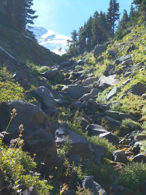
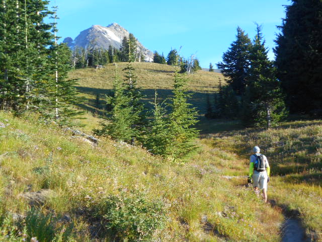
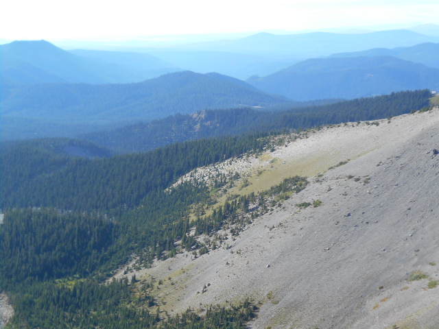
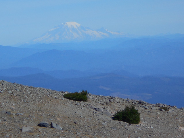
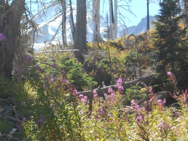
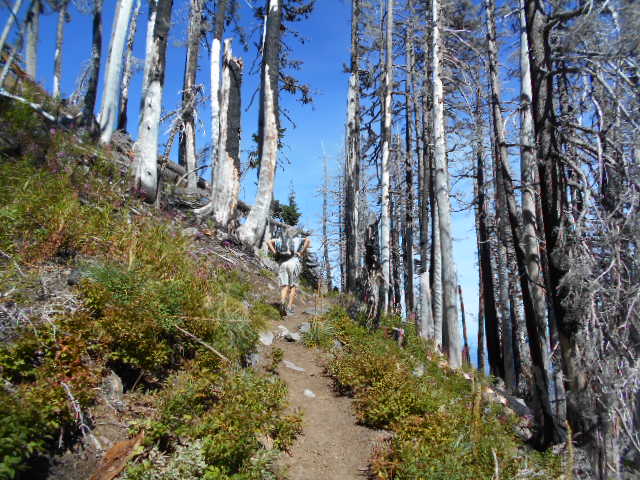
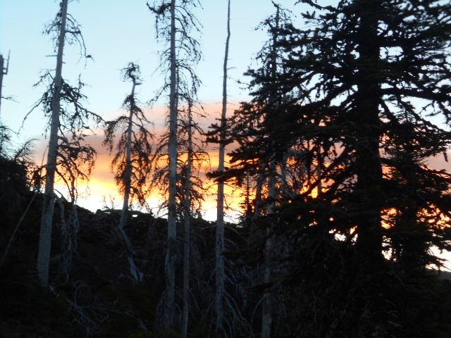
The trail becomes more reasonable after climbing out of Eliot Branch as we continued through a glade of bleached out burned trees, highlighted with lots of perky fireweed. The middle miles of the loop took us around many ridges and across streams that drained the watersheds between them. The mountain's summit would come into view whenever we cleared the forest canopy and was joined by Mt. Adams, Mt. St. Helens, and Mt. Rainier, clearly visible to the north. The scenery was fantastic.
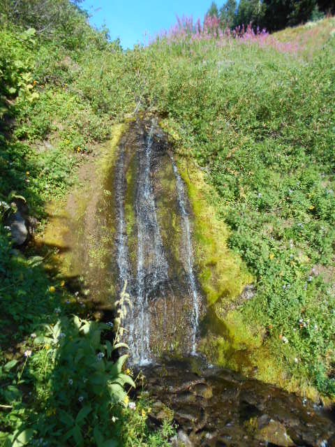
We stopped to eat regularly and drank freely from the many fresh seeps and springs along the way. Their waters were ever cold and refreshing in the afternoon's 60-70 degree temps. The names of the various spur trails, vistas, falls, and rivers escape me, but the trail offered endless variety as we continued our circumnavigation.
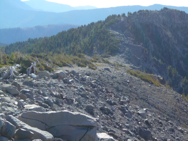
The middle twenty miles of the route around the north side of the mountain were generally downhill until we reached the low point of the day. At one river crossing, John and I crossed at different points and were separated for about an hour before we found each other and continued on our way. From the low point at Rushing Water Creek we made a long sustained climb of 2600' in four miles, bringing us to within five miles of the Lodge and the finish of our day.
While the surface of the trails around Mt. Hood are generally soft, not graded too steeply, and very runnable, we were nonetheless worn out by the end of the day. 42 miles is still 42 miles; and over 8000 feet of climbing is still a healthy challenge for any single day's effort. Reaching the cars just after dark at 2030 made for a 14-hour day. Given that we lost at least two hours with mis-cues, it was a great adventure and I think we both enjoyed the shared experience. Without John's help and experience I might still be out there flailing. Backpacker Magazine ranks the Timberline Trail as the toughest day hike in America. Having done 8 of the top 10 most difficult of these day hikes, I cannot argue.
John
Coffey has the FKT, 6h24m33s, set in a race on August 28, 1982.
Lynn Harmon has the women's FKT, 7h15m17s, set in the same 1982
race.
Rod Bein has the unsupported FKT, 7h38m, Sept. 3, 2014.
OVERVIEW
OF CW LOOP: Here are the major
waypoints you will want to remember followed by approximate
mileage from the lodge.From Timberline Lodge (0.0) - over open
slopes to the ridge above Zig-Zag Canyon (2.2) - down through
the canyon, over creeks, to Paradise Park (6.1) - you will see
Slide Mountain and Rushing Water Creek (7.5) - soon you will
cross the Sandy River and head towards Ramona Falls (10.2) -
continue towards the Muddy Fork (13.3) which actually requires
two stream crossings - then a long series of uphill switchbacks
takes you up to McNeil Point from which you will be able to
see the Lost Lake Basin - cross McGee Creek (18.3) - when you
reach the Cairn Basin Rock Shelter (19.5) you will have two
trails to choose from at this point, the right fork is .4 miles
shorter and leads you above Eden Park - towards Wy'east Basin
(20.4) - reaching Elk Cove Tr. #631 (22.7) you will start to
notice the soil and vegitation begin to change as the climat
becomes drier - continue along beautiful trail towards Cloud
Cap Saddle Campground (27.5) and into the "dry zone"
where little grows, fill your water bottles - cross the route's
highest point Lambertson Spur 7320' (30.0) - dropping and gaining
elevation on the many ridges, across open, rocky slopes, you
will go past the junctions of Gnarl Ridge Tr. 652 (32.3) and
Newton Creek Tr. 646 (33.7) - cross Clark Creek (34.6) until
you get to the White River Crossing (38.3) where you will have
to look hard for a good, safe place to cross - from here it
is about 2.5 miles of uphill, sandy trail back to Timberline
Lodge (40.7) Running the flats and downhills and hiking the
uphills, this took us 11 hours and 51 minutes at
an easy pace (with time for 150 photos, water stops and no pressure);
in 2006 we didn't take pictures and ran/hiked the loop in 11:19.
Most people we met on the route wanted to do it in 4 ten mile
days. Either way is awesome!
DETAILED CW DESCRIPTION: The trail begins behind the lodge.Go West, below/in front of Timberline Lodge.Keep going West, at about the same elevation. You go just above a ski lift that comes from below, and cross the bottom of another ski lift that goes up. Eventually it becomes the Mountaineer Trail. Keep going West and a little up until it joins the Timberline Trail (400) which is also the Pacific Crest Trail (PCT - 2000) at elevation 6000 feet and mile 0.8 from the start.If you don't find the Mountaineer Trail, just go West/up until you find the obvious PCT.Keep going West on the PCT.At 1.2 miles, the trail makes a brief descent into rocky Little Zigzag Canyon, an easy, bridgeless crossing. For the next mile, the trail descends into forest, passing the Hidden Lake Trail (no. 779) on the left. There is a campsite (but no drinking water) below the trail just before this junction. There's another campsite (with no drinking water) below the trail in another 0.1 mile.There is a small stream at mile 2.0. It gets to be a trickle late in the season but I've not seen it dry up.The Timberline Trail then curves across a series of sloping meadows before suddenly reaching Zigzag Overlook, the lip of gaping Zigzag Canyon at 2.4 miles. The view includes the meadows of Paradise Park, across the canyon, and rugged Mississippi Head, the mesa-like formation at the head of the canyon.From the Zigzag Overlook, the trail quickly descends a cool, forested slope to the bottom of Zigzag River Crossing at mile 3.5 and 4800 feet elevation. The stream is generally easy to cross without wet feet, but can occasionally present an obstacle during periods of heavy snowmelt. Be sure to look upstream for dramatic Zigzag Falls, which often forms snow caves at its base.From the canyon floor, the trail climbs steadily, crossing a side stream, then reaching a junction with the Paradise Park Loop Trail at 3.9 miles. Turn right here and continue climbing through switchbacks. You could stay on the PCT/Timberline Trail (through forest, only one signed junction go straight, several nice campsites next to Lost Creek) but going through Paradise Park only adds 400' elevation gain and no additional mileage and is well worth it.On the Paradise Loop Trail, at mile 4.9 is the junction with the Paradise Park Trail and the beginning of the sprawling alpine meadows of Paradise Park. It's 5.5 miles down to the Paradise Park Trailhead near highway 26.Continue on the Paradise Loop Trail. Cross Lost Creek at the 5.1 mile mark. This is a reliable source of drinking water year-round. A little further are the remains of the Paradise Park shelter in a grove of ancient mountain hemlock. There are a couple campsites here, but better sites are ahead. Inexperienced people are tired from the hike and drop their packs right here, so these sites are often taken.You'll be going through exceptionally scenic meadows, punctuated by rocky bluffs and Mount Hood towering above. There are also excellent views of the rugged Zigzag Mountain arm of the Mount Hood Wilderness, to the west, and the Salmon-Huckleberry Wilderness, to the southwest.The trail reaches about 5800 feet elevation in Paradise Park.Next, the trail crosses another branch of Lost Creek. This is another reliable drinking water stream. There are a number of nice campsites here. You can go straight up at the stream. You can go a little further and then down a trail to the site of an old lookout. You can keep going down to another more sheltered site. A little further on the Paradise Loop Trail is another trail going down to a campsite. A little further is a trail going up - in about 0.1 mile is a huge rock, maybe 20 feet high, with a campsite next to it (very exposed in bad weather). There are two plaques on the rock memorializing two former Forest Service employees.There are a couple more campsites just below the trail.The Paradise Loop Trail comes within a few hundred feet of Paradise Branch canyon, before turning downhill in a switchback. If you have the energy and interest, walk through low alpine scrub and meadows to the edge of the canyon for a sweeping view of Mount Hood, Reid Glacier and several waterfalls on the Paradise Branch.After taking in the view, return to the main trail, and begin a gradual decent back to the Timberline Trail/PCT, reaching a well-marked junction at 6.3 miles. Turn right (northwest). The trail takes a long stretch steeply down.At about mile 9.3 the trail gets close to Rushing Water Creek and several campsites off the trail a bit, next to the creek, which is good for drinking water. It's kind of cool here if you have hot weather.At mile 9.4 the trail crosses the Sandy River. This is one of the more difficult stream crossings around Mount Hood. You have to cross on rocks/logs. There's no bridge. See Tips for Crossing Streams.In the next mile, up to Ramona Falls, there are maybe a dozen campsites near the trail, explore any side trails you see. Get drinking water from Rushing Water Creek at the Sandy River crossing or at Ramona Falls. There's also a small stream below the trail at about mile 9.7 at a low point of the trail at about 3300 feet elevation.The trail now goes along the Sandy River stream bed. At mile 9.8 is the junction with the Ramona Falls Trail. The PCT goes left, but it's more scenic and slightly shorter to stay right (unless you want to go to the Ramona Falls Trailhead which is left).At mile 10.4 is Ramona Falls. This is a scenic spot that can be very crowded on summer weekends.Just after Ramona Falls is a trail junction. We want to take the Timberline Trail which goes right. The Ramona Falls Trail goes left.If you want, you can take the easier Ramona Falls/PCT Trail route. Follow it for 1.8 miles to the trail junction with the PCT. Go right on the PCT where it immediately crosses the Muddy Fork. There have been a couple bridges here that have been washed out. Currently there are a couple trees with a rope to hold onto. There are plans to put in another bridge. Then it's 2.3 miles up to the four way junction. The PCT goes left and eventually down to Lolo Pass or you can get down to the Top Spur Trailhead. Right is the trail around Bald Mountain. Straight is the Timberline Trail which is what we want. In 0.4 miles we connect with our route. This bypass is a total of 4.5 miles. Our route is 4.7 miles, slightly longer, but more scenic.We are not doing this bypass, but are going right on the Timberline Trail just after Ramona Falls. In 2013 this trail was closed for a while. There are several short stretches where the trail crosses a slide. At one place someone slid down and had to be rescued. The bypass might be better for some people.At mile 11 is the junction with the Yocum Ridge Trail which goes right (up). We want to go straight.At mile 13.1 is the beginning of the Muddy Fork, a couple nice campsites, and a good drinking water stream.The next half mile are several difficult crossings of the Muddy Fork. The trail can get somewhat overgrown at places and it's difficult to find it.At mile 15.0 is the unmarked cutoff trail. It's right after the horse blocking fence. If you go straight, you cross Bald Mountain with some excellent views. It's 0.4 miles to the four way junction.We want to go right on the unmarked cutoff trail. It's 0.05 mile up and over to the Timberline Trail where we connect to the bypass. Go right.At mile 15.2 is the junction with the McGee Creek Trail which comes in from the left (1.3 miles to the McGee Creek Trailhead). Stay straight.At about mile 16.4 are several viewpoints that look up to Mount Hood and down into the Sandy River Canyon. From the PCT junction to here is pretty crowded summer weekends. There is a place for a tent just above the trail in the brush next to the first viewpoint. There's another place for a tent right at the high point.At mile 16.9 is the unmarked junction with the McNeil Point Scramble Trail. You could take this loop for 1.5 miles until it rejoins the Timberline Trail. It's an extra 0.5 miles and 300' of elevation gain. The first part of the trail up to McNeil Point is very difficult - requires you use your hands a bit. There is a year-round drinking water stream and a number of nice campsites.At mile 17.5 is the signed junction with the Mazama Trail #625 (previously known as the Cathedral Ridge Trail) which comes up from the left. It's 3.1 miles to the Mazama Trailhead.A little further is the old McNeil Point Trail, now closed for revegetation. There's a nice campsite. There's a drinking water stream that probably dries up in September.At mile 17.8 is the signed junction with the McNeil Point Trail. This officially maintained trail is a much easier side path to McNeil PointAt mile 17.9 is a somewhat difficult stream crossing of one branch of Ladd Creek. This is the outflow of the Glisan Glacier above. This stream is too silty to drink out of, but there's another small stream that would be better, right next to the main stream.In the next several miles, up to Eliot Creek, are several areas burned by the Dollar Lake fire of 2012. There were fingers of fire that burned up to and across the trail. The trail is totally passable. A few trail signs got burned up but they have mostly been replaced by temporary signs. A few campsites have been burned, mainly in Cairn Basin, but there are unburned campsites nearby. Maybe the biggest risk is that trees have been burned, killed, and weakened, so they might fall over on you. But, this is becoming less of a risk because there have been a couple winters to blow over the weakest ones.At mile 18.2 is the junction with the Eden Park Trail which goes left. You could take this trail, and loop around to the Vista Ridge Trail and then back up to the Timberline Trail taking an extra 0.5 miles, and losing and then regaining 300' of elevation. Eden Park is a very scenic meadow area.Right after the Eden Park Trail junction is Cairn Basin which goes for about 0.2 miles along the Timberline Trail. There's one of those stone shelters, which could be a life saver in a storm. There are about 6 campsites all along here on both sides. If they're all busy, try taking the trail up past the shelter and you can find a few more campsites.The trail is at about 5800 feet elevation here.At the far end of Cairn Basin, at mile 18.4 is another somewhat difficult stream crossing, the other branch of Ladd Creek. It's too silty to drink.At mile 19.3 is the junction with the Vista Ridge Trail #626. This is the return from the loop through Eden Park. It's 2.7 miles to the Vista Ridge Trailhead.At mile 19.4 is Wy'East Basin, a scenic alpine meadow. There aren't any good places to camp here. There's a nice drinking water stream. There is an unmarked trail going up to Barret Spur.At mile 19.6 is the junction with the Pinnacle Ridge Trail #630. It's 3.4 miles to the Pinnacle Ridge Trailhead.At mile 19.9 is an unmarked side trail going to the right (up) to Dollar Lake. It's easy to miss this trail. There are usually some cairns to mark it. Dollar Lake is 0.3 miles from the Timberline Trail. There are three established campsites there. They may be full on summer weekends, this is a popular place summer weekends, surprisingly because it's so far from any trailhead. From here, there's a one mile side trip up to Barrett Spur. You can get drinking water from Dollar Lake, but people and animals swim there and there's no inflow or outflow so not the best water. If you keep going up towards Barret Spur there are some campsites and a drinking water stream.At mile 20.6 is Elk Cove and the junction with the Elk Cove Trail #631. This is a nice meadow area with great views towards Barret Spur and Mount Hood. There are about six campsites along the Elk Cove Trail within 0.5 miles of the Timberline Trail. These are in the forest and usually aren't that busy. You can get drinking water from the stream going through Elk Cove.At mile 21.5 is the difficult crossing of Coe Creek. Elevation here is about 5100 feet.At about mile 22.7 are two campsites within about 0.2 miles of each other. They are sheltered in the forest and right next to the trail. There aren't too many people walking along here so they're not too bad. You can get drinking water from a branch of Coe Creek or three branches of Compass Creek that are nearby.At mile 24.7 is the difficult crossing of Eliot Creek. The Forest Service has officially closed this crossing but many hikers are successfully crossing. See Eliot Creek Crossing for several possible crossings. (observed 9-16-2014)My current favorite is to go up the unmarked trail on the top of the ridge (moraine) on the West side of Eliot. Go 1.1 miles to elevation 7050 feet. Then, go down the steep, loose slope. This looks difficult and dangerous but I find it to be the easiest route. You get down to the Eliot flood plain at 6850 feet elevation. Then cross the flood plain 0.4 miles to the other side, gradually losing 100 feet of elevation. This could be dangerous, because there are rocks and gravel covering the glacier underneath. It's really loose so a big rock could shift when you step on it and you could break your leg, or you could fall into a crevass. I fear if enough people cross this, eventually, someone's going to get seriously hurt, so be very careful. There is no trail or cairns, but you might find some boot prints. There are some routes through here that are easier, and some more difficult. When you get to the other side, go up the climber's trail up the East moraine. You can see it from the West Moraine. As you cross the flood plain, aim for the bottom of this trail. Then, continue on the unofficial trail to the Cooper Spur shelter, at mile 26.6 and 6800 feet elevation.A lot of people cross down below, at "the ropes". See Eliot Creek Crossing.From the shelter, cut across slope (East) on a faint trail over to the Timberline Trail.Continue up the Timberline Trail to mile 27.9 to the Timberline High Point. This is the highest point (7350') of the Timberline Trail. There are a couple streams before the high point until late August, and there's another drinking water stream just after the high point. In September, this stream may only flow in the late afternoon and you may have to dam it up to form a pool and wait for the silt to settle before you can get water. There are a couple ridges that go east from the trail with some flat areas for a tent, but this is extremely exposed and not good in bad weather.In another 0.2 miles, there's a high area above the trail, which is the highest point of Gnarl Ridge, where you can find a flat area for a few tents. This is a little more sheltered than the Timberline High Point. There are a couple streams.At about mile 28.5 there's a spring a ways to the East of the trail. This was dry in early September. Maybe if you went downhill there would be a place where there was water.After a while, the Timberline Trail follows the top of Gnarl Ridge with excellent views. At about mile 29.3, the trail leaves the top of Gnarl Ridge and there's the remains of one of those stone shelters and on the opposite side of the trail are some flat areas that could hold an army of tents.At mile 30.7 is the junction with the Gnarl Ridge Trail #652 which is 3 miles down to the Hood River Meadows Trailhead.At mile 31.5 is the difficult crossing of Newton Creek). It's a little hard finding where the trail exits the canyon on the West side. It's pretty much opposite the East side - you don't have to go a long ways upstream or downstream. Look around for a rope or flagging. Just after the crossing are several nice campsites a little off the trail. There's also a small drinking water stream.We're down to 5400 feet elevation here, and stay at about that elevation across the Mount Hood Meadows area.At mile 31.8 is the junction with the Newton Creek Trail #646 (3 miles down to the Hood River Meadows Trailhead). Walk a short distance down here for some excellent views south.At mile 32.9 is a somewhat difficult crossing of the Clark Creek. At mile 33.7 is a nice waterfall at Heather Canyon and a somewhat difficult stream crossing.Over the next 2.5 miles are a number of beauteous streams and little water falls and several campsites. This is all in the Mount Hood Meadows Ski Area, so you see occasional signs of man, but it's a novelty compared to the wilderness so maybe its okay. You normally see ski areas when they're covered with snow. At least there aren't zillions of people.At mile 35.2 is the junction with the Umbrella Falls Trail #667. Just before this is a gravel road, the only one you'll see on the entire Timberline Trail. Just before this is Mitchel Creek, the last time you'll find drinking water for a while. After the trail leaves the meadow and enters forest, at the next switchback in about 0.1 mile, there's a spot above the trail that's flat enough to sleep. Neither of these are that great.Then you go steeply down to the most difficult crossing of the White River Crossing at mile 36.7. There are large flat areas to sleep at if you brought drinking water from Mitchel Creek or Timberline Lodge. The White River is too silty to drink out of. The trail on the West side is about 0.2 miles upstream from the trail on the East side. Between is a route flagged and/or marked with cairns. The exact route varies from year to year.At mile 37.5 is the junction with the PCT which comes up on the left from Barlow Pass, 4 miles away. Stay right on the Timberline Trail/PCT.At mile 38.9 is the end of your trip, back at the Timberline Lodge parking area.