Climb Storm Mountain, Kananaskis - Alberta, Canada
Elevation Gain: 3445'.......... Summit: 10,155'.........Distance: 7km / 4.5 hours RT
July 10, 2017 (Monday)
Storm Mountain shares the Misty Range with Mount Arethusa and Mount Rae and sits directly east of the Elk Range consisting of Mount Pocaterra and Mount Tyrwhitt. The only published route up Storm Mountain is the moderate scramble via its larch filled southwestern slopes to the more challenging south ridge. It is a short day scramble due to its proximity to Highway 40. You are treated to northwestern views of the Royal Group, including Mount Sir Douglas. In my opinion, this Highwood Pass region serves up the most scenic and accessible high alpine foliage in all of the Canadian Rockies as well as has an abundance of mountain sheep.
GETTING THERE: Take the Kananaskis Trail (Highway 40) exit off of the Trans-Canada Highway between Calgary and Canmore. Drive to 4.4 km past the Highwood Meadows Interpretive Trail parking area at Highwood Pass. Park at a pullout on the right for the Lost Lemon Mine. Check for Bear and Lion Advisories/Closures ahead of time. The closest camping is a backcountry site at Elbow Lake, 1.3 km in on Big Elbow Trail several kilometers south off of Hwy 40. There are tons of camping options further north at Kananaskis Lakes. You cannot camp outside of the marked specific camping areas in Kananaskis. Take helmet, ice axe and bear spray. No permit required.
From Montana Hwy 93 cross the border at Port of Roosville, then 42k north to Elko, BC; turn right on Hwy 3 toward Fernie and Crowsnest Pass - drive 123 to Lundbreck, AB on Hwy 3 before turning north on Hwy 22 for 111k to Longview; soon after turn west on Rt 541 for 80 to 90k to Highwood Pass. Park at the Lost Lemon Mine pull off just 4.4 km south of the Highwood Pass parking area.
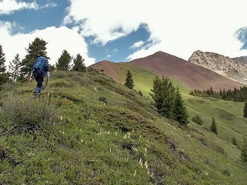
Hike a few meters northwest along the road to your first drainage area and follow its left side up and onto a trail that takes you back into a cirque.
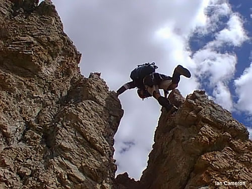
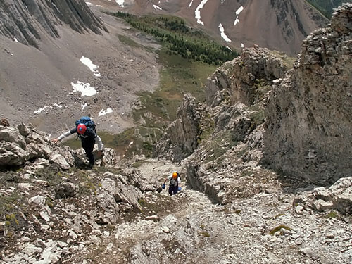
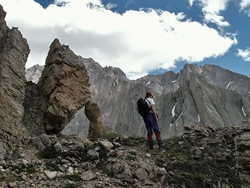
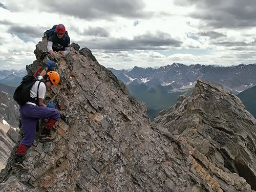
Once the meadow ends proceed at an angle up the left side to gain the south ridge of Storm Mountain. This will involve hands on scrambling that rarely gives way to feet only. You are aiming for the easiest break on the ridge, the least rugged section of the col. There was a pole in 2004 marking a good place to attain the ridge. Go farther up the valley and ascend the scree slope there to gain the ridge instead of ascending prematurely. Then plod up to the east summit. From here the south ridge looks daunting, particularly when covered in snow. An eastern ledge (right side) does not look a whole lot less exposed. I started out on the ridge, four points of contact in many spots and finally down climbed onto the eastern ledge to proceed at a better pace.
I continued on this ledge angling leftward at all times aiming for the summit. Finally you reach some lower 5th class climbing sneaking through a hole on the north side. If there is no snow, I imagine the ridge is inviting on the south side for the final approach. I had mini storms moving in and out on me, so my views were limited. There was a summit register in 2004.
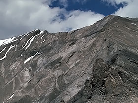
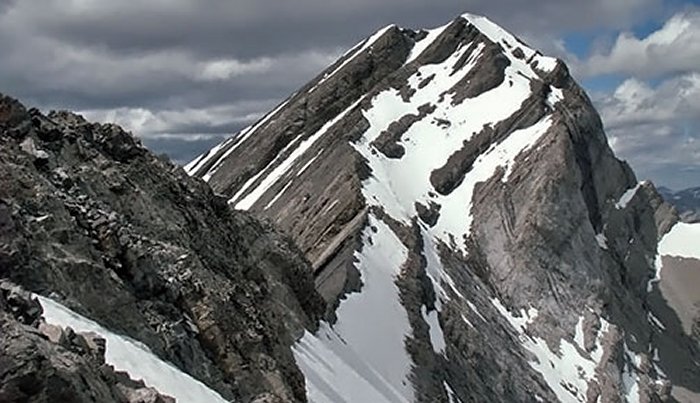
On descent, I chose to cross over a precarious snow covered notch to gain the west ridge. This took some courage as the west ridge is not visible from the summit and I was dealing with 2 feet of fresh powder. However, once one carefully maneuvers the ridge down about 400', you will find angles in which to start your descent. This optional descent demands experience with route finding to get off the mountain. Once down to Storm's cirque (next one west from where you ascended), just follow the drainage (waterfalls when I was there) to the road.