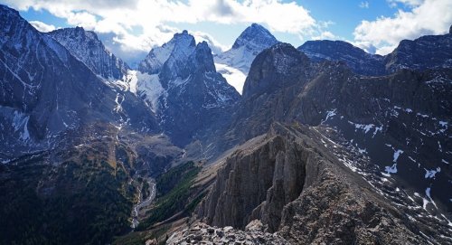
Panorama north and west includes, Leval, White Man, Vavasour, Snow, Warre, Eon, Birdwood, Pig's Tail, Smuts, Commonwealth,
 Tent Ridge, Commonwealth Ridge, Fortune, Nestor, Engadine, Tower, Galatea, Gusty and Fortress..
Climb Mount Burstall, Peter Lougheed PP - Alberta, Canada
Elevation Gain: 2952'.......... Summit: 9056'.........Distance: 11km / 3 hours RT
July 12, 2017 (Wednesday)
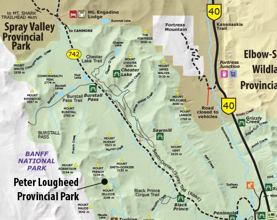
GETTING THERE: From the Canmore Nordic Center, drive 40 km south on the Spray Lakes/Smith Dorrien Road (gravel). Turn right at signs for the Burstall Pass day use parking lot. The closest camping is located back at the north end of Spray Lakes Reservoir across the damn at random campsites located on the west shore of the lake. You cannot camp outside of the marked specific camping areas in Kananaskis. Check for Bear and Lion Advisories/Closures ahead of time. There are tons of camping options further north at Kananaskis Lakes. You cannot camp outside of the marked specific camping areas in Kananaskis. Take helmet, compass, ice axe and bear spray. No permit required.
Mount Burstall resides in the middle of the Spray Mountain Range just north of Mount Murray in Kananaskis Provincial Park along with such notables as Shark Mountain and The Fist hemmed in to the west by the 11,172' Mount Sir Douglas on the Continental Divide. Mount Burstall was officially named (as most mountains in the area) after a WWI Lt. General in 1918. It was first ascended in 1972. The only published route up Mount Burstall is the difficult rated scramble. It is one of the shortest routes in Kananaskis and one of the more pleasant in terms of footing. Although rated difficult by one of the local guidebooks, it definitely is on the easier side of difficult if not a more moderate climb. I took the summit on a stormy fall day, but was still afforded dramatic views into the French and Robertson glaciers. On a clear day, the views would be similar to Mount Murray and therefore include the big three in Kananaskis, Mount Sir Douglas, Mount Joffre and Mount Assiniboine. To the north are views of Mount Engadine and Mount Chester.
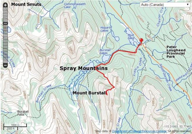
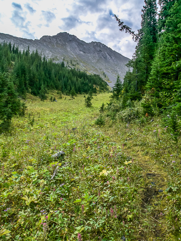
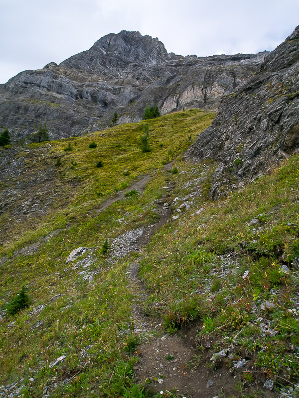
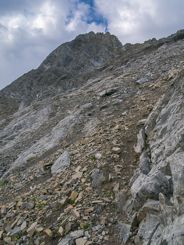
Run along the Burstall Pass Trail until you reach a large boulder in the center of the trail. After just a few more minutes on the trail you will notice a treed avalanche gully on your left. Proceed up the right side of this avalanche gully following a decent animal trail, if you can find it, until it tops out above tree line at 7500' onto a broad avalanche area exposing the col east of Burstall. Gain this col at about 8500' and then proceed to your right, staying below the ridge on the south side, following an animal trail and then large talus to finally gain the summit ridge.
There is no magic to getting this peak. Make sure you're far enough up the trail before venturing up the valley - you should be on a faint trail the entire way. When I did this peak there was an obvious cairn and some flagging. I've read of people venturing up the climber's right side to access the col but this is usually regretted by those who attempt it. The terrain is steeper and more exposed than it looks from below. I went on the rock rib that you see between the two black scree slopes and this worked really well.
This last 350’ is the difficult portion. Follow ledges below the right side of the ridge until you find yourself below an overhanging block on the ridge itself. Continue to the left in a human size crack making a few moves to eventually gain the ridge again. Scramble up the ridge carefully to the summit. Watch the exposure on the north side of the ridge.

x