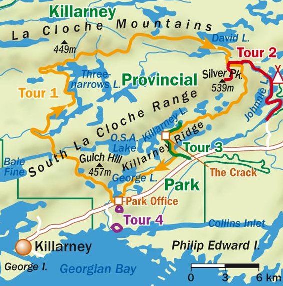
La Cloche Silhouette 78K Loop, Killarney Prov. Park, Ontario
3110 metres of elevation gain
Twilight 0711    Sunrise 0741    Sunset 1843    Twilight 1913     Weather Forecast
October 10, 2024 - MAP (detailed maps at bottom)
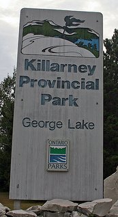
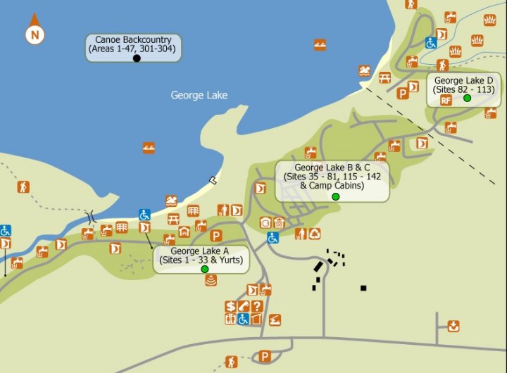
GETTING THERE: GPS: 960 Hwy 637, Killarney, ON - From Toronto, travel Highway 400 N for 138 miles to Barrie where the highway turns into Highway 69 N for another 66 miles before turning west on Highway 637 (before reaching Sudbury) for 40 miles toward Killarney and Georgian Bay. Mapquest Travel time estimate from Toronto ~ 5 hours. The trailhead of the La Cloche Silhouette Trail is located at the main park campground where we will camp the nights before and after the run at George Lake in Killarney Provincial Park (reservations at right).
ALT ITINERARY FOR BACKPACKING:
     Day 1:   Arrive; George Lake tent camp site A#30  (Booking #CC18-2320-16)
     Day 2:   Hike 22K; tent camp H37 (Booking #CC18-2320-17)
     Day 3:   Hike 18K; tent camp H23
     Day 4:   Hike 18K; tent camp H8
     Day 5:   Hike 14K to finish; Depart        (Reservations #: 888-668-7275)
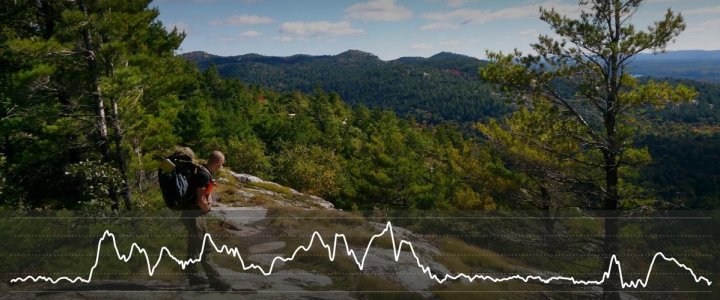
By Ontario standards this is one of the most difficult trails in the Province. It is in this park where Ontario’s only mountain range exists. Lush forests, stunning white quartzite rock, steep, rocky ascents and descents, and beautiful views make this trail unforgettable. Mid-fall is one of the worst times to run the trail, as the combination of less daylight, freshly fallen leaves, persistent rains and high winds may create less than ideal running conditions. Sounds perfect to me. With this in mind we will watch for a fair weather window and start early, hiking the trail counter-clockwise – the benefit of this is that we'll tackle the most difficult sections on fresh legs.
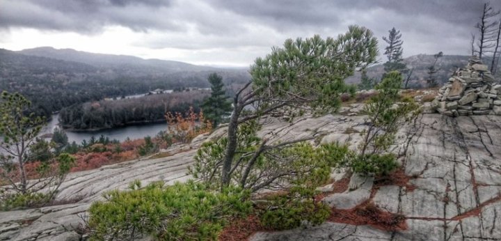
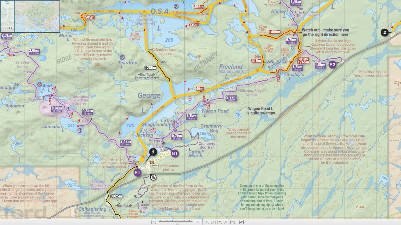
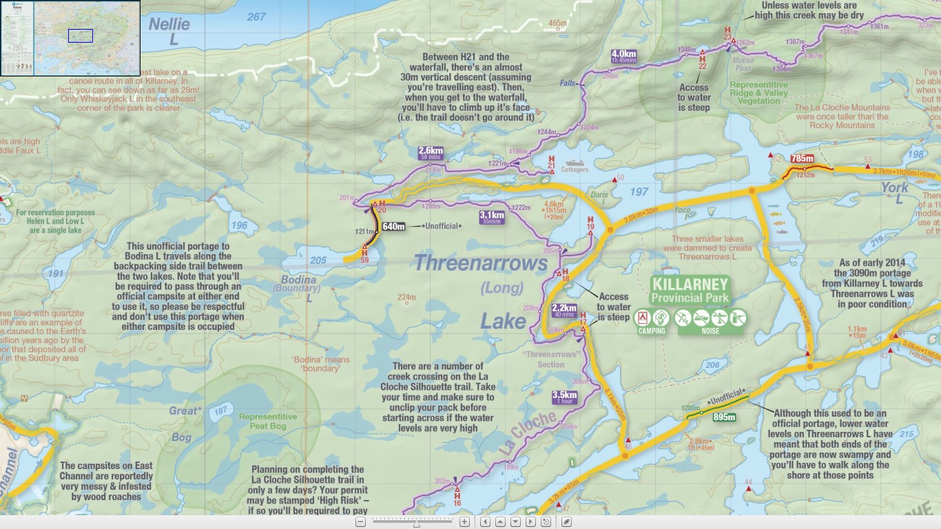
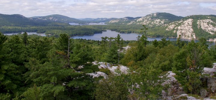
Section 1 (8-10km) Known as the Killarney Ridge, starts with a bang. This trail varies from rocky outcrops to red/white pine woods to lush deciduous forests, featuring “The Crack” (see photo above right and map below), which is a large chasm that we'll have to climb through, navigating large boulders and pre-Cambrian rock. The view at the top is absolutely stunning and worth every step.
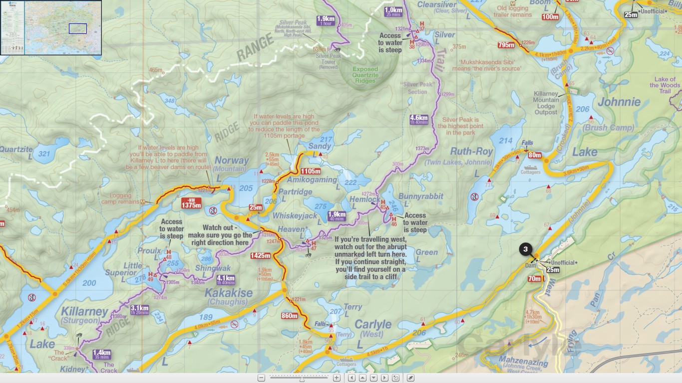
Section 2 (15-17km) Known as Silver Peaks, will take us through some beautiful old wood forest with massive white pines. There is definitely quite a bit of elevation gain and loss, but there are some beautiful flat sections as well, some of the most rewarding parts of the hike - running across the quartzite top with the wind in your hair, surrounded by beautiful views. My ind of adventure.
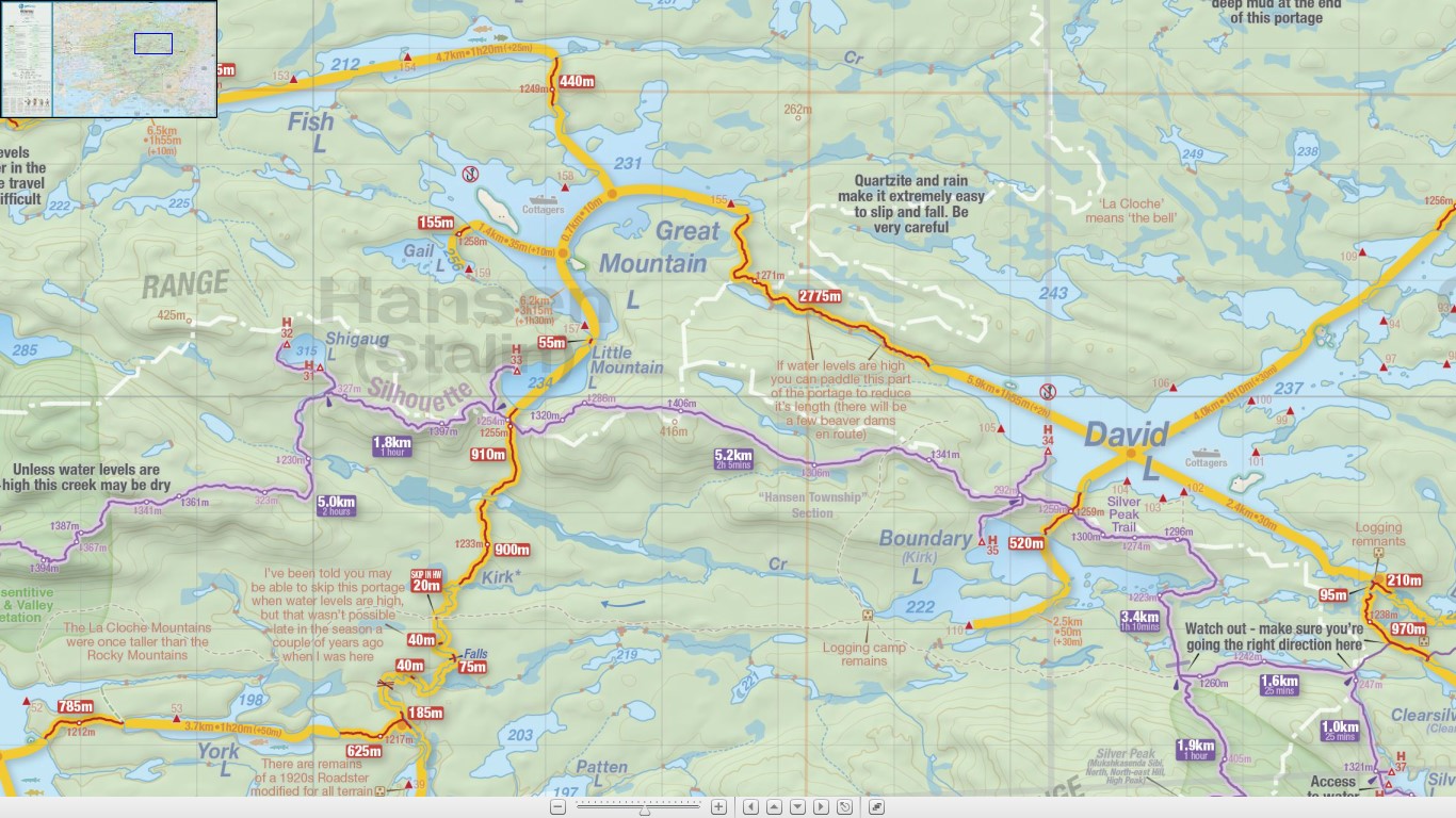
Section 3 (15-16km) Known as Hansen Township, full of ups, downs, lefts, rights, and every which way. It seems any headway to gain in elevation is thwarted by a quick descent, which then leads to another ascent. It’s fairly consistently difficult, but you’ll be rewarding by constant gorgeous scenery. The white pre-Cambrian rock mixed with the lush green forests and clear blue of the lakes creates such a serene image that it’s tough to not want to rest just a little bit longer at each break. Shigaug Lake is a beautiful spot; with an almost perfectly clear dead-lake it’s tough to beat.
Section 4 (19-20km) Known as Three Narrows, known for the lake that it traces,where the trail becomes easier and a good place to spot moose or deer.
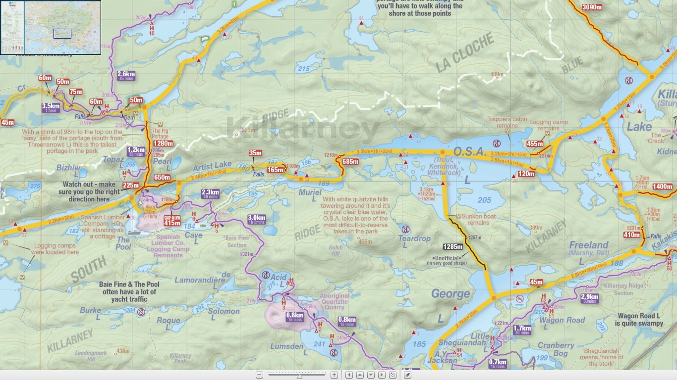
Section 5 (14-16km) Known as Baie Fine, known for its rolling hills and beautiful mixed wood forests. While it appears flat, it is ever so gradually an ascent that never quite ends. In comparison to the rest of the trail though, it’s a breeze! Check out Topaz Lake, a Caribbean blue lake that you have to see to believe.
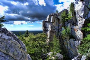 the Crack on La Cloche